Tasmania road trip with waterfalls, wildflowers, and tranquil RV stops in the highlands.
RV Travel Through Tasmania's Hidden Gems
Sue and John Turner take a trip through the highlands in Tasmania and discover a world of scrubwrens, waterfalls and wildflowers.
It was late afternoon, and we were heading downhill on a narrow dirt road in our 2014 Fiat Jayco motorhome in northern Tasmania. Back at the turnoff, the sign said six kilometres to Liffey Falls. Several 4WDs came around a bend heading our way. There was only room for us or them on the narrow road. Thankfully, they were able to pull over before reaching us, allowing our camper to pass without going off the edge of the road. It was quite a drop-off. When we arrived, the car park was empty, a sign said it was a 45-minute walk. It didn't say if that was one way or return. Going down was easy. Coming back up is not quite so easy. Liffey Falls is not just one waterfall… but a series of drop-dead gorgeous waterfalls.
Tasmania Road Trip Ideas Off the Beaten Track
Just before lunch that day, we had left my sister's place at Gretna in the Derwent Valley, heading for home going 'over the top', through the highlands. It is about 60 to 70 kilometres shorter distance to our home in north-west Tasmania than going through the Midlands, the only drawback being the steep descent with a few tight U-bends in the northern section towards Deloraine.

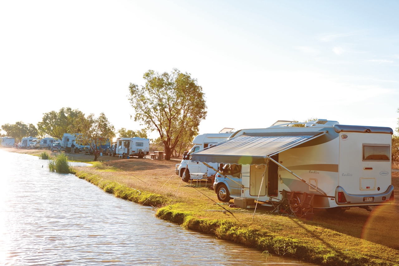
Sue and John's home on wheels at Blackburn Creek Rest Area
Scenic Bush Stops and Motorhome Travel in Tasmania
Our lunch stop was Blackburn Creek Rest Area, a beautiful little free bush camp. The creek gurgled around the rest area, much higher after recent rain; then we had a short stop at the historic Steppes Homestead. This isolated old homestead was built in 1863, when sheep grazing was popular in the highlands, and was home to members of the same family until the last one passed away back in the 1970s. It is in quite good condition, the grounds now used by groups for camps; as well as a tourist attraction. Just down the road and also connected by a bush walk is a circle of sculptures in the bush. A little brown Tasmanian scrubwren accompanied us around the circle.

Steppes Sculptures
Add This to Your Scenic Drives in Tasmania List
We didn't take the dirt road into the old Waddamana Hydro Electric Power Station. Classified as a Heritage site and now operating as a museum, it was first commissioned in 1916. A place to go to another day. I remember going there on a school trip in the 1960s and taking our kids there in the 1990s when touring Tasmania.
Around Great Lake: A Highlight of RV Travel Through Tasmania
Once onto the Central Plateau at an altitude of around 1,000 metres, the highway passes around the side of Great Lake. As the name suggests, it is quite large. Thirty kilometres later, we were still going around Great Lake. The road was sealed a few years ago. It is fairly flat, but the landscape changes every few kilometres. Evidence of a bushfire that went through much of the area a few years ago is still there. Being such a cold area, it is taking a while to recover. Quite a few shacks line the banks of the lake, grouped in areas with several launching ramps for the keen fishermen, but no shops apart from a couple of strategically placed hotels. Water was rushing through the channel into Great Lake at Liawenee, one of Tasmania's coldest places and the site of possibly the loneliest police station in the State, stuck in the middle of the plateau. The dam wall to Great Lake is an interesting place to stop, to see the succession of walls that have raised the level of the lake over time. Being a fairly flat plateau, there really isn't much of a catchment for the lake – the level seeming to fluctuate over time, with water drawn off for Poatina Power Station.
Wildflower Walks in Tasmania's Highlands
Wildflowers abound on the plateau, with different flowers open at different times of the year and at different altitudes. I remember a few years ago we stopped to pick wild mountain pepper berries, a rare treat if you can beat the birds. After a break to see a friend in his shack overlooking Great Lake, we paused at Little Pine Lake to see the wildflowers. At around 1,200 metres it is close to the highest point on the highway. It was a cool brisk walk. A lazy wind was blowing, the sort that goes straight through you. A couple of weeks before we had passed this area on our way south. At that stage we didn't notice any wildflowers in bloom. This time was totally different. It was like a wildflower garden with the lake and rocky mountain as a backdrop. The rocks in that area give the impression of being a rock fall as opposed to a waterfall.

Little Pine Lake Walk
Scenic Drives in Tasmania End with a Worthwhile Detour
Leaving the top, we made our way down to about the halfway mark where John decided we were going into the Liffey Falls; a place we have been a few times in the past but not for a while. And this was where we met the four-wheel-drives coming the other way.
Final Stop: Deloraine and a Warm Meal
It was 7.30pm before we got to Deloraine and our overnight spot at the RV Park near the dump point, tired and starving hungry. Sometimes we fit a lot into the day. We called into the Information Centre to pay the $3 camping fee the next morning, on our way out of town.If you ever find yourself needing an overnight RV stop and aren't sure where to head, the CMCA Traveller App powered by Geowiki is a handy resource worth checking out. Deloraine is always a nice little town for a walk, either along the riverbanks or through town and to the supermarket. We hadn't seen a supermarket for a week, so it was time to stock up before we headed for home.
Planning a Tasmania Road Trip Through the Highlands?
Going 'over the top' is a different way to travel in Tasmania. The road is sealed around Great Lake, through Bothwell and to the Lyell Highway which runs through the Derwent Valley from Hobart to Queenstown – but if you turn off at Great Lake Hotel for Bronte Park, be prepared for a few kilometres of rough road.
Meander River running through Deloraine