Setting out on the historic route
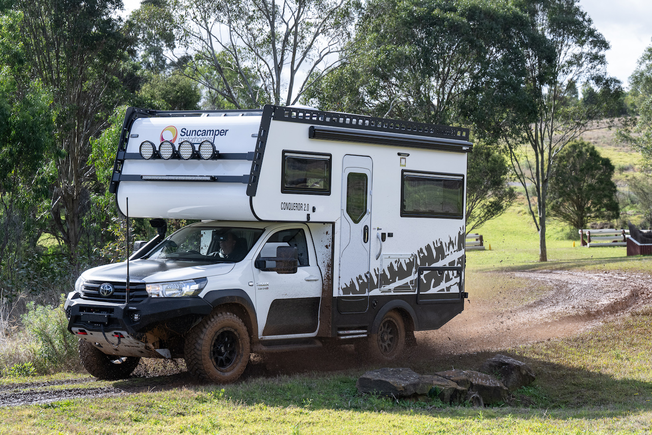
“You won’t get through in that!” This is a familiar refrain from 4WD drivers when they see us with William, our Suncamper Conqueror, and ask where we are going. His bulk and seeming top-heaviness give a false impression which is belied by his balance, agility and power.
So we were not surprised to hear it when we mentioned we were going to ‘do’ the Holland Track – an iconic 4WD track from the south-west of Western Australia to Coolgardie in the Goldfields. It has a length of 680 kilometres from its original starting point of the village of Broomhill, south of Wagin; and after the last town of Hyden, there are 350 kilometres without a town Holland settlement, mine, cattle station or farm.

Origins of the Holland Track
It has a fascinating history, related like so much in WA to mining. In 1892 gold was discovered in Coolgardie some 600 kilometres east of Perth. As a result, the population of WA swelled almost overnight with huge influxes of prospectors from the eastern States and overseas. There were no means of land transport to WA from the east so prospectors sailed from either Sydney or Melbourne, landing in Albany in the south. The trouble with disembarking in Albany was that there was no known direct route from there to the goldfields.
The enterprising group of John Holland, brothers Rudolph and David Krakouer, and John Carmody left in April 1893 from Broomhill, 86 kilometres north of Albany; and two months later in early June they had cut a cart track through to the goldfields – a feat that would be envied by today’s road makers particularly given that they left with five horses, a dray and a compass. It then became the quickest and most preferred route for prospectors, 18,000 of whom are estimated to have used it, before it quickly became redundant when the railway from Northam was extended to Coolgardie three years later.
John Holland was a Broomhill local sandalwood cutter and kangaroo shooter who knew the area and was accepted as the leader of the group and hence had naming rights to the track and the highest peak along the route, Mt Holland. Depending on which history one reads there is some controversy about that. Convictssouthwestwa.com.au reports the Krakouer brothers were the financiers of the expedition resulting in them lodging a claim with the WA Government for reimbursement of £393 for expenses they incurred, which seems to confirm that they were indeed the financiers. Their claim was declined and the only thing that links them now to the track is the name given to an impressive granite outcrop, Krakouer Rocks. John Carmody is remembered by a lake named after him near Hyden.
Starting Point: From Perth to Broomhill
We leave Perth and travel on the Brookton Highway and stay overnight on a roadside lay-by just south of Wagin, known for its sheep industry with an effigy of a ram and its modern meatworks. From Wagin we head 74 kilometres further south-east to Broomhill, the official start of the Holland Track. Regrettably, for some 300 kilometres it is not possible to follow the original Track as the woodland through which it had passed has been cleared and converted to wheat and sheep farms. So from Broomhill, we spend the day zigzagging on well-formed and well-maintained gravel roads through and around farmland interspersed by the many salt lakes. After passing through the town of Katanning we stop for a cuppa at the large once freshwater but now saline Lake Ewlyamartup.
The lake is used for recreational purposes and there are picnic tables, a toilet, shelter, barbecues, a bird hide and a boat ramp. It is a refreshing break from the seemingly endless wheat/canola and other grain paddocks. We pass the smaller Lake Coyrecup and continue our zigzagging until we see a sign pointing to ‘Jam Patch Soak’ in a patch of bushland with an icon of a man pushing a handcart. We pull in to investigate, finding only a pleasant camping area but no information on the soak other than a further icon pointing into the bush. We reason that as there are no indicators of distance or time needed it must be relatively close … and we set off to explore. After 40 minutes of religiously following a string of carefully placed signs that line both sides of the narrow foot track through close shrub and more open woodland, we still haven’t sighted the soak.
As we haven’t brought any water with us we decide to keep going for 10 minutes; whereupon we turn back and retrace our steps. We are certain by the imagery on the sign that this was a part of the original Holland Track. We decide to explore it on the internet when we set up our Starlink on return. Unfortunately there was no information available that we could find.
After a lovely quiet night, we set off the following morning and before long we were on the original route of the Holland Track heading for the intersection with the Hyden-Norseman Road. We could have simply crossed the road and continued on the Track but instead we turned west to pop into Hyden for petrol and an ice-cream and Sodastream cylinder refill.
The Holland Track from Hyden (approximately 350 kilometres) is generally described as a two to three day trip. As is our usual practice we take double this time, as we are slow travellers and are not time-poor. It is recommended that it be driven in summer as most rain in the area falls in winter – making the track notoriously boggy. It is obvious from the severely cut-up, rutted track that ‘real 4WDers’ enjoy the mud. Some ruts are in excess of 1.5 metres. The track is so badly gouged that in places there are chicken tracks on chicken tracks – or as Brian preferred to label them – ‘wisdom tracks’. The downside of the dry track though is that the weather can be very hot. We experienced temperatures in the high 30s each day.

After meeting the Rabbit Proof Fence that runs from Salvation Bay east of Esperance to 80 Mile Beach in the north-west and running alongside it for a short while, we continued on to Sheoak Rocks, one of the many granite outcrops that line the Track and provided prospectors some water because of the runoff from the rain that collects at the base of the rocks. After exploring the Rocks and startling several Mallee Military Dragons, we settle in for the rest of the day.
Second Day on the Holland Track
Day 2 on the Track takes us past Native Rocks, Wattle Rocks and a Mallee Fowl nest that is just in off the Track. The vegetation changes regularly from shrubland with patches of crimson gravel or swamp bottlebush to woodland and back again. In between are the bare patches around the granite outcrops and the large devastated areas that have been subject to wildfire.
Where the woodland has been spared by the fires, the stunning colours and sheen of the olive/russet gimlet trunks are spectacular as are their shiny leaves. Distinctive salmon gums and some taller older eucalypts add variety and majesty.
The extra height of William adds some additional challenges as Brian navigates the tight corners between the trees and the mallee stumps sticking out from the sides of the Track and the deep ruts while avoiding the overhanging branches. It is a gnarly track with our average speed being 6-8 km/h for much of the day. The best that we can do sometimes is pick the least worst line and pray when we realise that not all four wheels are on the ground at the same time.
At the junction with the road up to Mt Holland we meet five vehicles, each with one driver, who are travelling in the opposite direction. They wave us through and we hear them lamenting on the two-way radio the dryness of the Track. They are the only people we meet between Hyden and Coolgardie.
Mt Holland provides a pleasant vantage point from which to view the surrounding countryside. After a trip to the top we carry on to the very pleasant campsite of Sandalwood Rocks for the night.
We have noticed sandalwood trees along the Track and the history of sandalwood is another interesting story for another time; but of note is the fact that it was WA’s (or the Swan River Colony’s) first commercial export being sold to China by the shipload from as early as 1844.
The Track follows the Dog Fence along a corrugated track for some distance until it abruptly ends – causing us to wonder at the expense and trouble of putting up a fence that the dogs (like us) can simply go around. At the intersection with the Banker-Mt Day Road there is a reminder of the Code of Conduct for the Track which is supplied, like others at both ends of the track, by the Toyota Landcruiser Club who ‘maintain’ the Track. Mostly the code is followed except for the travellers ignoring the request not to use wood fires. Also at the intersection is a metal suitcase on a stand containing a Visitors’ Book and evidence of our dry Aussie humour. Some wags have added a full stubby of Carlton Dry and a stubby-holder, KFC wipes, fly spray and Aeroguard, children’s plastic toys, a dog ball, a screwdriver, a COVID test kit and a face mask.

Encounters Along the Way: Landmarks and Flora
Krakouer Rocks, the next morning, is an impressive geological feature that makes us wish we had a tag-along geologist to explain the lines of different textured and coloured rocks that pattern the rock faces like feature tiles on a floor. We bemoan the lack of opportunity to see this in wet weather as there is plenty of evidence of substantial rock pool chains and waterfalls from one level to another.
Moving on we come to Agnes Gnamma Hole, named after John Holland’s wife. Indeed in this rock formation, which is not named but we assume to be Agnes Rock, there are several gnamma holes. We pass by Diamond Rock, not bothering to walk in as it can’t be seen from the Track and we reason that it is probably low and unimpressive if we can’t see it from 200m away. We have just lamented that the only wildlife we’ve seen in the past couple of days has been a couple of euros or small kangaroos … when we see two Goulds Goannas in quick succession. 
Fire scarred trees in the next patch of woodland show how severe the fire damage has been but again the resilience of gum trees is demonstrated with seemingly dead trees giving rise to new growth that either sprouts from the roots or from the burnt trunks and seems to envelope the damaged trees with new growth. There is evidence that in this area the fire damage has been so great that graders have been required to clear the burnt wood from the Track. Perhaps this is why the Track seemed widened and improved until we came to an intersection with Victoria Rock Road, a very wide well graded road, along which we travelled to the turn-off to Victoria Rock where we spent the night of Day 4 on the Track.
It was from Victoria Rock, 76 kilometres south of Coolgardie, that John Holland sighted his destination of the goldfields at Bayley’s Find. The Shire of Coolgardie has established pleasant picnic and camping areas with toilets, tables, shelters and fire pits but once again we were the only ones enjoying the location and facilities. A Goulds Goanna did burst in on our yoga and meditation session the following morning, tearing down the slope of the Rock to come to a skidding halt half a metre from me. He regained his composure and moved slowly away to about two metres from us where he remained for about an hour before disappearing sedately into the undergrowth.
After another walk on the Rock we drove in to officially finish the Track at the Coolgardie Information Centre. We stocked up in the IGA, had a lovely hot $2 shower at the Recreation Centre and used the dump point at the Free 48-hour Camping Area at the old railway station.
Recommendations and Reflections: Insights for Future Travelers
In all we had spent six nights getting from Perth to Coolgardie and would recommend the Track to other 4WD adventurers, with late spring or early autumn being the more comfortable times to do it in. Knowing the depth and width of the ruts we certainly wouldn’t do it in the wet when water would cover a lot of the Track and hide the dangers. While we have heard of others with trailers completing the Track, it’s not something we would recommend as the corners leading in and out of the rutted areas of the road are often very tight and sometimes quite difficult to manoeuvre through.
Although not part of the Holland Track, we retraced our steps along Victoria Rock Road and continued another 30 kilometres or so to visit Cave Hill. We had not been there before and had no real expectations of it other than that it is another granite outcrop. But we were pleasantly surprised. Like at Victoria Rock, the Shire has created very pleasant camping and picnic areas around the Rock. The Hill is one of the largest and highest outcrops in the area and has several interesting formations worth visiting. We enjoyed two nights at Cave Hill before moving on to the Eyre Bird Observatory where we would spend a week as Brian joined a bird photography course.